About
Company Overview

VS Safety Enterprise is an India based company with head quarter in historical city of Jaipur in the state Rajasthan. It was established 3 years ago, in Aug 2020.
VS Safety Enterprise started it entrepreneurial journey with providing industrial safety solutions and products to government sectors and private enterprises.
Our drone journey started in 2021 with forging partnership with Ideaforge Technologies.
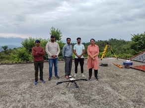
In the year 2022, we’ve started Drones As A Service model. Where in we have hardware, software and human resource at hand.
We have proven capabilities in various dimensions like in
Agriculture – crop health monitoring, damage assessment, yield estimation, land preparation, irrigation planning, and crop counting,
For Mining – Site planning, site monitoring and maintenance, mapping and surveying, inventory tracking, and live maps for accurate data capture.
Survey and Inspection – For accurate and real time data for Land and Road Survey, Progressive Monitoring and Property Survey .
Where in output is Orthomosaic,3D point cloud, Digital Terrain Model, Contour Mapping, Stockpile Calculation, Object Marking and Surface Analysis.
Surveillance and Security supplying UAV’s and Services for Anti – Terror, Coastal and Boarder Security, Crime Control ,Disaster Management, Forest and Wild Life, Traffic monitoring and Emergency Responder.
We started the GIS data post processing facility with high end systems in our Jaipur office in 2023.
In next 2 years, we plan to expand in international drone services market.
About Us
Mission
Develop sustainable and efficient drone workflows to enable organizations in achieving great values
Vision
Be the leading Drone based Service provider of the country
Next-Gen Mine Surveying: Advanced Drone Solutions for Precision Mapping & Reporting
In the rapidly evolving landscape of the Indian mining sector, staying ahead requires more than just traditional methods. Our comprehensive Drone as a Service (DaaS) model provides mining enterprises with high-fidelity data, ensuring operational efficiency, safety, and strict regulatory compliance. From the rugged terrains of a Rajasthan mine to large-scale industrial quarries, our aerial intelligence transforms how you manage your assets.
Precision Mine Survey & Drone Mapping Solutions
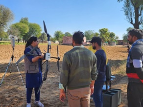
Traditional surveying is time-consuming and often hazardous. Our Drone survey and Drone mapping services utilize state-of-the-art UAVs to capture high-resolution geospatial data in a fraction of the time. By deploying a DJI Survey workflow or utilizing a Make in India drone, we generate accurate 3D models and orthomosaic maps that serve as the foundation for your entire operation.
Key Applications:
- Topographic Mapping: Detailed contour maps for site layout and drainage.
- Haul Road Optimization: Analysis of road grades and widths to reduce fuel costs and equipment wear.
- Safety Monitoring: Identification of unstable slopes and hazardous zones without risking personnel.
Accurate Stockpile & Volumetric Estimation
Inventory management is the backbone of mining profitability. Our Stockpile estimation services eliminate the guesswork and human error associated with manual GNSS surveying.
Using advanced photogrammetry and LiDAR, we provide Volumetric estimation with centimeter-level accuracy. This data is critical for:
- Monthly Production Tracking: Reconciling excavated material against planned targets.
- Financial Auditing: Providing auditable, timestamped digital records of your inventory.
- Logistics Planning: Optimizing the movement of ore and overburden.
Comprehensive Mine Report & Regulatory Compliance
Compliance is no longer optional. Under recent mandates, such as the Rajasthan Minor Mineral Concession Rules, a detailed Mine Report backed by aerial data is mandatory for lease renewals and annual submissions.
We provide end-to-end support for:
- IBM SOP Compliance: Ensuring all survey data meets the strict standards of the Indian Bureau of Mines.
- Digital Elevation Models (DEM): High-precision terrain data required for statutory reporting in any Rajasthan mine.
- Boundary Demarcation: Legally defensible maps that ensure your operations remain within your lease boundaries.
Specialized Surveys for the Mining Lifecycle
Our expertise extends beyond daily operations into the strategic phases of mine development:
Mine Auction Survey
Before bidding, you need certainty. A Mine auction survey provides high-resolution data on topography, existing infrastructure, and mineral potential, allowing for competitive and informed bidding strategies.
Mine Planning Survey
Effective design starts with accurate data. Our Mine planning survey services provide the 3D intelligence needed for pit design, waste dump placement, and infrastructure development, ensuring long-term operational viability.
Why Choose Our Drone Services?
- Indigenous Technology: We prioritize the use of a Make in India drone to support local innovation and ensure easy maintenance and compliance with DGCA regulations.
- Advanced Hardware: For ultra-high precision, we utilize the latest DJI Survey equipment, including the Matrice 350 RTK and Mavic 3 Enterprise series.
- Expert Analysis: Our GIS team doesn’t just deliver photos; we deliver actionable intelligence through comprehensive reports and data formats compatible with your existing planning software.
Ready to digitize your mining operations? Contact us today for a consultation on how our Drone as a Service can streamline your next Mine survey.